Solar Cells South Bruny, Tasmania, Australia
By TeamSwampy on 05-Nov-05. Waypoint GA0249

Cache Details

Difficulty:
Terrain:
Type: Traditional
Container: Small
Coordinates: S43° 22.343' E147° 17.169' (WGS 84)
  55G 523182E 5197791N (UTM)
Elevation: 568 m
Local Government Area: Kingborough

Map

Planned (1)
Cache Tracker
Mayor
QR Code
Log Count
Public Tags
Private Tags
Rating

Description

A short slighty inclined bushwalk to the summit.

This bushwalk is along a well marked trail, which leads to the highest point on Mt Mangana. The trip is signposted as 1.5 hours return but shouldn't take that long unless one of you have little legs. Distance is approximately 1.8k from the carpark to the top, elevation change of 131m.

Parking for about 6 cars is available at the trail head on Coolangatta Road here: S43 21.382 E147 17.190.

Once you reach the second summit where the towers are, head to the right of the solar cells and the small building and follow the track through the bushes. The track stops just past these and the cache is a liitle further on from here. Cache is easily found when standing just past it. I have attached a photo of where you should be standing to find the cache.  

I have taken a new set of co-ords at my last maintenance visit and updated the listing because I don't want cachers to leave without finding it.


When placed, the cache contained: a pack of cards, mini pen, mini highlighter, bounce ball, paper punch, glue stick, pencil, off-road car and a horse. Placed by Swampy and Team Tweeti

Hints

Haqre n snyyra gerr whfg cnfg ynetr ebpx.
ROT 13: ABCDEFGHIJKLM
NOPQRSTUVWXYZ
Decode

Logs

This cache has been temporary disabled for over 90 days, so we will be archiving it to de-clutter the database.

When the cache is ready to be activated again the owner can place a 'published' log and it will go live
 
04-Nov-11
I think this one may have gone so I will check it out and replace if necessary. Sad
 
04-Nov-11
It was a bit disappointing not to find this one after the walk up here, but the walk itself and the views made up for it. I'm positive we identified the correct place that matched the picture clue, but the cache was nowhere to be seen.
 
28-Apr-11
Well it all started at 9am
Started the walk at 9am with the boss and the mini cacher (on mini cachers birthday)big 4 now
Arrived at GZ and started the hunt 1hr later nothing
phone a friend option...looked again nothing
by this time mini was getting a little restless so we had to GIVE-UP
great spot for a cache tho


maybe one day might try again
Back at 4x4 12.15pm


09-Oct-10
Things we do for a piece of Tupperware hidden in the bush. About half way up it started pouring with rain and the wet weathers had to come out. Do we keep going or go back? A quick check of the GPS under my coat reveals only 600M to go (in a straight line). We decided to keep going in the fading light, the cloud on the ground and pouring rain. Not sure what our logic was as the only attraction was the caches because the view was non existent. Anyway for some strange reason we bagged the cache and the nearby trig and retreated to the car to dry out on the way back to camp.
 
09-Aug-10
Hi Swampy - Great cache found after logging Mount Mangana at 1608hrs. Loved the walk in and out until I slipped on the footbridge 20metrs from the cachemobile and buggered up my thumb. Thought I'd broken it, but went to hospital on the 10th; it was dislocated and a small fracture. Oh, the joys of caching. Thanks for taking me to a place I'd never have gone were it not for geocaching. Good views and the walk is relatively easy. Cheers and TFTC; OldSaint.
 
12-May-10
A nice stroll though the bush. Views were limited as the trees have grown up a bit. TNLN Thanks
 
30-Jan-10
We found this an a very hot day. We were going to get Clear Blue Sky but decided to go for this as it should be cooler in the rain forest. The path was quite overgrown towards the top of the mountain. Views were spectacular, although they were obscured by the trees. Cache was found quickly, despite not having the benefit of the picture. Thanks Swampy for a top cache. TNLN TFTC
 
05-Jan-10
Had a great bushwalk with the whole madchilli mob to this cache, 9yo, 5yo and 9 months... Great views from cache site and 2 for 1 with the nearby TP. Thanks for bringing us here swampy as we probably wouldnt have done without there being a cache here
 
21-Apr-09
Mt red tag was on Bruny for work and decided to miss one ferry in order to grab this cache. Hmmmmm.....1 hr 30 mins return , 1 hr 45 mins to next ferry; things could get interesting.........
Headed up the trail through a small patch of rainforest, and as Sirius said, surprisingly gentle slope and a REALLY nice forest walk. I enjoyed this immensely! Not much views from the top (trees and cloud) and the cache was quickly found. TNLN as I was really prepared for work. Thanks for the cache, Swampy!

And yes, I did make that ferry!
 
20-Jan-09
Great walk,found thanks to picture and clue.
took mini highlighter, left racecar
 
03-Jan-09
Stopped to nab this cache on way back from Sth Bruny Lighthouse. A good walk and cache found by 6 yr old son with a bit of searching.
Thanks Team Swampy.
 
06-Sep-08
Updated co-ords and listing. Last maintenance visit was 19 Jul 08.
 
04-Sep-08
Cache #5...and things getting more sirius. Trail start is no longer sign posted...but just past the eastern lookout..on the left. The trail up is surprisingly a very gentle grade. Cache found with aid of exc. hint...I did retake co-ords...but accidentally deleted them later...drats....but my GPSr was showing around 5m to east of cache. Standing on the highest rock...extensive views over the southern parts with snow capped peaks making a superb vista. Hot footed back out...all up time of 59m. TNLN...TFTEC...Swampy...Cheers.
 
11-Jun-08
Easy find,though the cache itself is a little bit further off the waypoint than usual on both my GPRSs ( this might explain the DNFs below ). Should have retaken some co-ordinates but didn't think of it at the time. Had H10, R12 and T14 wandering around so had some good coverage to find. TNLNSL.

 
12-Oct-07
found after a little search , great views little tacker enjoyed the chalenge not sure of swaps lost all paperwork thanks for the trip
 
This was the first walk we have taken in Australia which has given us some appreciation for the term - "busk walk". The damp woods were actually reminiscent to us of the rain forests of the Pacific northwest, with gums instead of cedars and doug-firs. Anyway we were relieved to get to the top and take in the view (our second trek of the day) but after poking around for some time we came away thwarted by the hide. Drat - I doubt we'll get up there again, but if we do, we'll be sure to bring a smart Schnauzer! Oh well, thanks for the exercise.
 
10-Feb-07
Can't believe this has been so long since it was last found. Coordinates were good and a nice hide. Took us about 10min. to find. It was quite cloudy when we were there but as we left the clouds were as well turning into a top day. Second cache for the day. Took the off road car and left 2 Devils key ring!! SL TFTC Team Swampy & Team Tweeti
 
19-Sep-06
SEARCHED FOR 1 HOUR,COULD NOT FIND,MAYBE NEEDS HINTS,MAYBE CACHE NOT THERE ANY MOORE ?
 
26-Nov-05
On my trip to Bruny I planned to hit the caches furthest from the ferry first, and as I wanted a good leg stretch we started with Swampy and Tweet’s cache. It was a lovely little walk, under tree cover for much of the way, so this should be lovely even on a hot day, however this also kept the track nice and slick.


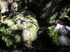
moss
Mossy track


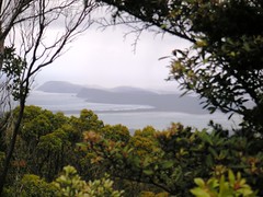
Unfortunately the slaves didn’t have any amusing falls but they didn’t do the track with the same effortless, fluid movements that I did to traverse this distance. The cache wasn’t difficult to locate. Having come into the open, we could now see what we were about to experience: a rain cloud.


solar
Rain on the way!

It started to hit us as we hit the track for our return but didn’t amount to much. The sky was blue and sunny by the time we reached the cacheMobile. Thank you Swampy and Tweeti!!

 
Kingborough (M) - dragonZone
0.00 0.00
0.00 0.00
dragonZone Points
Downloads
GPX file
ZIP file
Gallery
Gallery
Other
Graph
Plot